KSAF - Santa Fe Regional
Located in Santa Fe, NM, USA
ICAO - KSAF, IATA - SAF, FAA ID - SAF
Airport Type
Civil
Lat/Long
N35-37.0/W106-05.4
Elevation (ft)
6349
Fuel Available
AVGAS JET
Current UTC
1:31:03 AM (-7.00)
Approaches
ILS LOC GPS
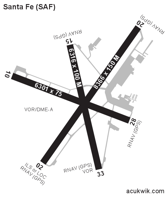
Longest Primary Runway (ft)
8366 x 150, 02/20
Runway Surface
Asphalt/PFC
PCN
Local Standard Time
7:31:03 PM
More Airport Information (Click to expand)
Airport Light Intensity
MEDIUM
US Customs Pre-Clearance
No
DST
2nd Sun in Mar 0200L to 1st Sun in Nov 0200L
Control Tower Hours
0700-2100L
Distance from City
9 MILES SW OF CITY
Runway Diagram
FAA Diagram

Google Satellite Map of KSAF
Airport Distance Calculator
The distance from to is
Nautical Miles
Airport Restrictions and Information
FBOs
Fuel Info
Brand INDEPENDENT
Hotels
Doubletree Hotel Santa Fe