KEGE - Eagle County Regional
Located in Eagle, CO, USA
ICAO - KEGE, IATA - EGE, FAA ID - EGE
Airport Type
Civil
Lat/Long
N39-38.6/W106-55.0
Elevation (ft)
6547
Fuel Available
AVGAS JET MOGAS
Current UTC
2:13:44 AM (-7.00)
Approaches
LDA/DME GPS
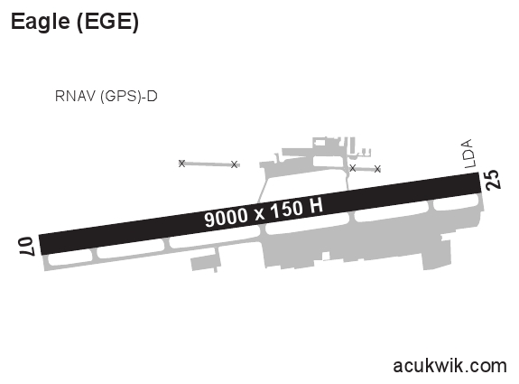
Longest Primary Runway (ft)
9000 x 150, 07/25
Runway Surface
Asphalt/Grooved
PCN
Local Standard Time
8:13:44 PM
More Airport Information (Click to expand)
Airport Light Intensity
HIGH
US Customs Pre-Clearance
No
DST
2nd Sun in Mar 0200L to 1st Sun in Nov 0200L
Airport Hours
Attended Apr-Nov 0700-1900L, Dec-Mar 0700-2300L
Control Tower Hours
0700-1900L
Distance from City
4 MILES W OF CITY
Runway Diagram
FAA Diagram

Google Satellite Map of KEGE
Airport Distance Calculator
The distance from to is
Nautical Miles
Airport Restrictions and Information
FBOs
Fuel Info
Brand INDEPENDENT
Prices Not Updated Last 90 DAYS
Prices Not Updated Last 90 DAYS